What is the Pacific Ring of Fire and why do the most catastrophic earthquakes on the planet occur there?
The Pacific Belt or Ring extends through a horseshoe-shaped strip that reaches 40,000 kilometers. Devastating earthquakes and significant volcanic activity are brewing in its bowels.

The Pacific Fire Belt (or Ring) is a geological formation that extends over 40,000 kilometers around the edge of the Pacific Ocean. This vast area extends from the west coast of South America to the east coast of Asia, passing through the Pacific islands and reaching the west coast of North America.
Its formation is closely related to the boundaries of tectonic plates that surround the Pacific Ocean, where the tectonic plates converge, separate or slide on top of each other, creating intense seismic and volcanic activity.
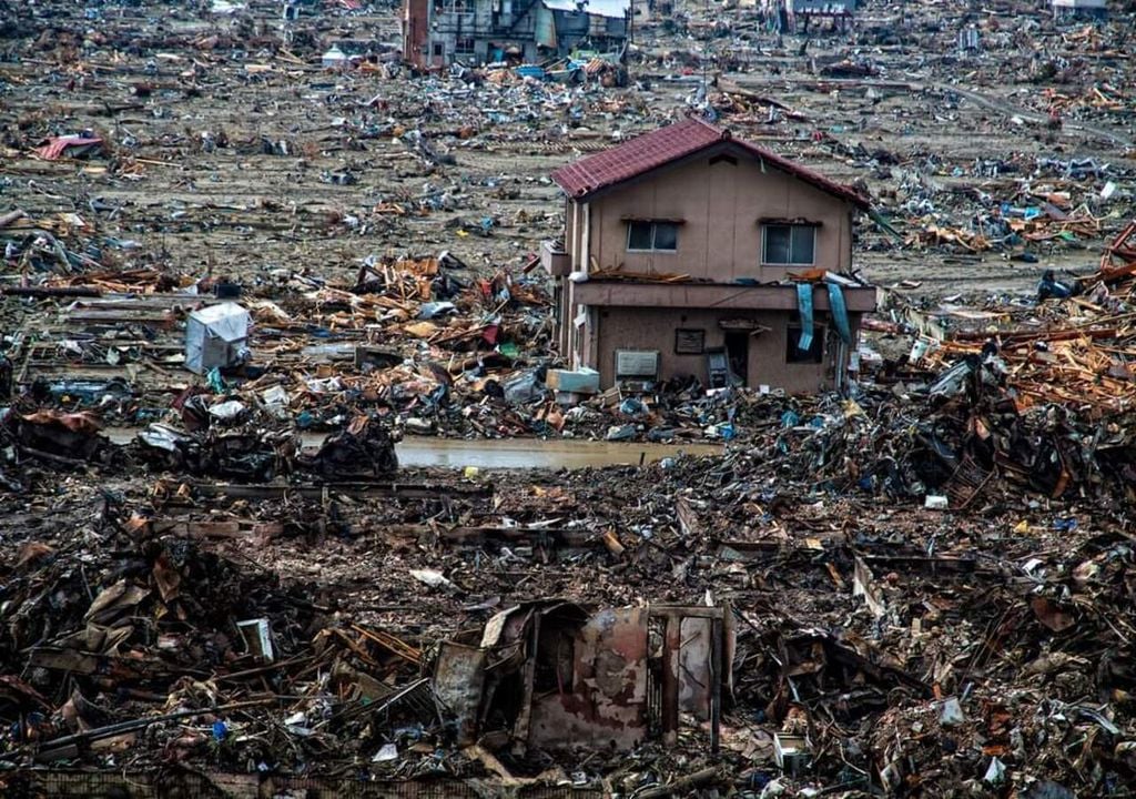
The most catastrophic earthquakes on Earth are being staken here
The tectonic activity in the Pacific Firebelt is the result of the interaction of several main tectonic plates, including the Pacific plate, the Nazca plate, the Cocos plate, the Philippines plate and the North Pacific plate. These plates are in constant motion and suffer friction between them, which causes great tensions in the earth's crust that are eventually released in the form of very intense earthquakes and volcanic eruptions.
El Cinturón o Anillo de Fuego del Pacífico se extiende sobre 40.000 km. Tiene 452 volcanes y concentra más del 75 % de los volcanes activos e inactivos del mundo. Alrededor del 90 % de los terremotos del mundo se producen a lo largo del Cinturón de Fuego. pic.twitter.com/BaiQTpuDg8
— Curiotweet (@Curiotweet1) May 11, 2022
The Belt of Fire encompasses numerous countries and territories that border the Pacific Ocean. Apart from Japan and the United States, this belt covers or has influence in nations such as Argentina, Chile, Mexico, Canada, Panama, Costa Rica, El Salvador, Honduras, Nicaragua, Russia, the Philippines, Indonesia, Tonga or New Zealand, among others.
Many of the most catastrophic earthquakes in history have occurred within this geographical area. Among them are the devastating earthquakes in Chile in 1960 and 2010, the event in Alaska in 1964, the earthquake and tsunami in Japan in 2011, as well as the catastrophic earthquake in the Indian Ocean in 2004.
Volcanoes and large volcanic structures
In addition to earthquakes, the Pacific Belt of Fire is known for its volcanic activity. The presence of numerous active volcanoes throughout this region makes it one of the most volcanically active places on Earth.
#Volcanes:
— Geól. Sergio Almazán (@chematierra) March 28, 2019
Cinturón de Fuego del Pacífico
¡Encargado de consumir casi toda la corteza terrestre antigua del planeta, engendrando así los violentos terremotos y los asombrosos volcanes!
Vídeo: https://t.co/bgxqJAKTlv pic.twitter.com/44oU4uPqYE
From the majestic Mount Fuji in Japan to the imposing Mount Rainier in the United States, the volcanoes of the Belt of Fire have left an indelible mark on the landscape and history of the surrounding regions.
Other seismic borders
Apart from the Pacific Fire Belt, we also find other areas that stand out for their great seismicity due to their interaction of multiple tectonic plates, which generates a variety of significant seismic events in different parts of the world.
The Alpine Seismic Belt
This seismic belt is responsible for approximately 17% of the largest earthquakes recorded in the world.
El terremoto de #Sumatra-#Andaman (#Indonesia-#India) Mw=9.1, es el terremoto más fuerte a nivel mundial en el siglo XXI, el sismo se produjo en el Cinturón Alpino-Himalayo, dónde se concentra el 17% de la sismicidad mundial, es el sismo más fuerte de dicha región.#EQVT, #gempa. pic.twitter.com/PCDwuSedhg
— American Earthquakes (@earthquakevt) March 19, 2019
It extends from Java to the Iberian Peninsula, passing through regions as diverse as the Himalayas, the Balkans, the Alps, Turkey, the Mediterranean and the Atlas.
The Mesoatlantic ridge
In the North Atlantic, the Mesoatlantic ridge separates the Eurasian and North American plates, while in the South Atlantic it separates the African and South American plates. From the seabed, the mountains rise between 1000 and 3000 meters high within the waters of the ocean.
#ElRoscoDeLasCientíficas
— Mujeres Con Ciencia (@mujerconciencia) December 31, 2019
T. La obra de esta geóloga demostró la existencia de la dorsal mesoatlántica que permitió el cambio de la antigua hipótesis de la Tierra en expansióna las teorías de tectónica de placas y deriva continental.https://t.co/eDwNTaRZWF pic.twitter.com/5QREYLfXQN
Although much of this ridge is underwater and far from human development, there is a notable exception: Iceland. Despite its remote location, this surprising island experiences significant seismic and volcanic activity due to its position on the Mesoatlantic ridge.


