
The ‘Pompeii’ of the Andes: Giant eruption buried an entire landscape
A giant volcanic eruption in Chile has given scientists a rare glimpse into the ancient Andes, revealing clues about how the mountains formed and changed over millions of years.
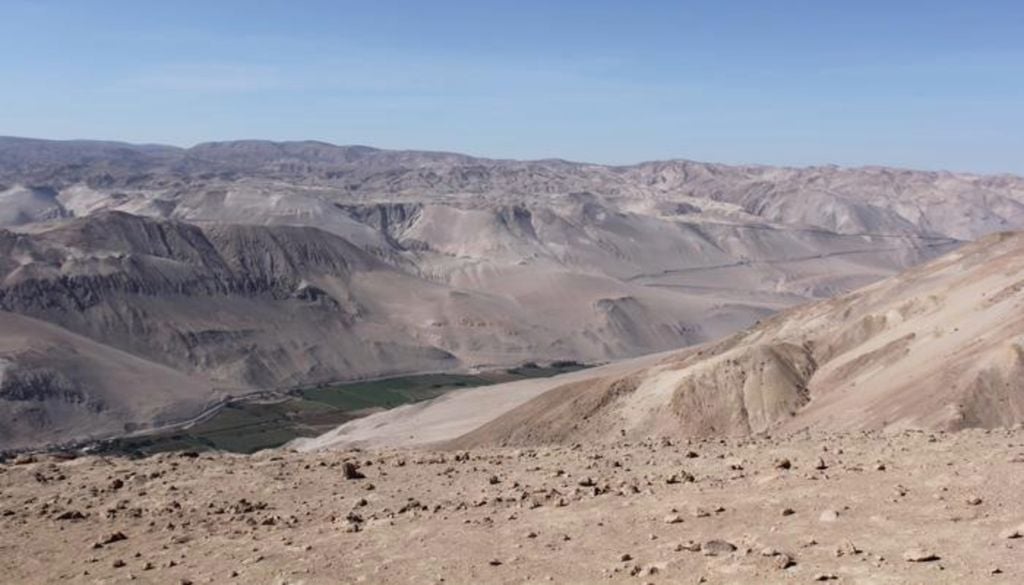
A new study published in Science Advances reveals that a gigantic volcanic eruption has acted like Vesuvius across an entire landscape, burying everything beneath it and preserving land that would have been lost to erosion.
Researchers studied the volcanic rock that erupted from Lauca Caldera in northern Chile 21.9 million years ago. The rock, called ignimbrite, covers an area 6 times larger than Chile’s capital city Santiago and can reach up to a kilometre deep.
Using models to map hidden lanscapes
The team simulated hundreds of possible landscapes, using models of how rivers shape mountain ranges, to see which ones could look like the landscape buried beneath the rocks. They discovered that only relatively low-relief landscapes – similar to gentle mountain foothills- would have been possible. They think this part of the Andes built up slowly, about 2.5 cm every 100 years.
If the rocks had been pushed up faster, the landscape could have developed steeper slopes which would not have fitted beneath the volcanic deposits.
The findings support the theory that the Andes grew slowly over tens of millions of years. This is slow compared to many rapidly uplifting parts of active mountain belts, such as parts of the Himalaya.
Dr Byron Adams, from UCL Earth Sciences, said: “This landscape was buried by a giant volcanic eruption - a little like Pompeii, but on a vastly larger scale. Instead of covering a town, hot mixtures of volcanic ash, rock fragments, and gas swept across an entire landscape, engulfing the terrain beneath them.
“Pompeii shows how volcanic eruptions can freeze a moment in human history. This study shows that much larger eruptions can also freeze moments in Earth history, burying whole landscapes beneath volcanic deposits and preserving clues to how mountains were being built before the eruption.
“We cannot dig down to see the buried landscape, but we can use the shape of the volcanic blanket and what we know about how rivers shape mountains to infer what is hidden beneath it.”
Volcanic rocks revealing geological records of time
The researchers noted that their uplift estimate matched earlier research on minerals in the rock that record temperature changes over the last 50 million years. The temperature changes reflect the rock cooling as it moves upward through the Earth’s crust.
Dr Adams added: “This approach gives us a new way to look back at Earth’s history. Current methods to estimate the speed at which mountains build look at chemical ‘clocks’ in the rock but these are limited to specific moments in time. Our method can estimate rock uplift over a much longer period.
“In this case, we estimate it would have taken millions of years to produce the subdued landscape we infer prior to the eruption.
“There is debate over whether the Andes grew slowly and steadily over 40 or 50 million years or whether they rose extremely slowly and then popped up more recently, in the last six to 10 million years. Our findings, which cover a large part of the middle of that history, support the slow but steady hypothesis.”
Dr Frances Cooper, also from UCL Earth Sciences, said: “We’ve been working in this part of the Andes for many years to understand how the mountains developed. The Andes have a major influence on regional and global climate, so reconstructing their history is important for understanding long-term climate change.
“What’s particularly exciting about this study is that it gives us a new way of piecing together that history. The same approach could be applied to volcanic deposits elsewhere in the world, helping us reconstruct landscapes buried for millions of years.”
News reference
Byron A. Adams, Frances J. Cooper, Clementine Walsh, and Katharine V. Cashman. (2026). Landscapes buried beneath large-volume ignimbrites reveal preeruptive uplift rates.