
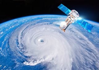
Intense tropical cyclones forming in the Atlantic will take names from the 2019 list. A WMO committee has decided to remove one name and replace it with another: here's why.
Duncan Wingen received formal training in meteorology as a meteorological observer candidate at the Spanish State Meteorological Agency (AEMET) in 2022. His academic background includes a climatology course at the University of the Balearic Islands (UIB) in 2016, two vocational training programs in physics and meteorology completed in Barcelona in 2019, and extensive specialized coursework through COMET.
He has worked for Diario de Mallorca, Diario de Ibiza and Mallorca Zeitung, producing weather forecasts for digital platforms and social media, as well as in-depth articles on meteorology. He also made weather forecasts for Diario de Ibiza. Between 2021 and 2023, he was a regular contributor to the program Cinc Dies de Ib3, where he delivered weekend forecasts and discussed a wide range of science and nature-related topics.
In October 2021, he published his first book, Los Secretos de los Cumulonimbos, with the publishing house Círculo Rojo, which has since reached its third edition. Since 2014, he has managed El Rincón Balear de la Meteorología across social media platforms, providing forecasts, weather monitoring, and public outreach. His research work focuses on Balearic meteorology and includes the first formal climatology of severe storms in the Balearic Islands, published in 2025 in the peer-reviewed journal Tethys, with Agustí Jansà as co-author. This research was presented at the European Meteorological Society Annual Meeting (Barcelona, 2024) and at the Aula Morán of the Spanish Meteorological Association in 2025. He is also the author of the first climatology of linear convective wind events, published in Revista de Aficionados a la Meteorología (RAM).
Duncan Wingen actively participates in meteorological forums such as Meteo Illes Balears and Cazatormentas.net and is deeply committed to making meteorology accessible to the general public, with a particular focus on high-impact weather events that pose risks to people and property.
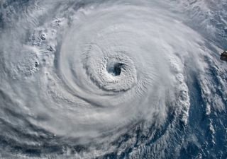
Intense tropical cyclones forming in the Atlantic will take names from the 2019 list. A WMO committee has decided to remove one name and replace it with another: here's why.
A recent study by NOAA offers an explanation for a curious phenomenon detected in some intense hurricanes: finger-shaped clouds protruding from the eyewall.

At the beginning of the year, a study warned of a possible collapse in the AMOC, with catastrophic consequences for the North Atlantic. Now another work published in the journal Nature throws another very different result.

One of the most eagerly awaited dates for astrophotography lovers is coming up. The next supermoon is just around the corner and it won't be the only astronomical event to mark on your calendar.

Several witnesses have recorded a rare "rain of fish" in Yasuj, Iran. The images may seem like science fiction, but it is not the first time that this phenomenon has been documented: this is the explanation of meteorologists.
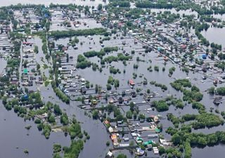
According to meteorologist Ben Noll, last March was the wettest on Earth since records began. This variable could be linked to climate change and events such as the recent torrential rains in Dubai.
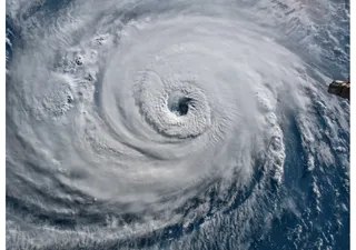
Early forecasts point to an extremely active tropical cyclone season in the Atlantic. The WMO has already proposed the list of names for this 2024, along with a supplementary list of 21 names.

The foehn effect produces a wide range of adverse phenomena in the mountains as well as truly spectacular temperature rises. We delve into the formation mechanisms and associated impacts.

Few clouds in the world have been given their own unique name. One of them is the Morning Glory in Australia, a type of low cloud with a spectacular appearance.